
Temple City Neighbor Lookup Sources
A block-level question works best when each source is assigned one task. Parcel tools locate land and link adjacent AINs. City planning identifies zoning. Civic sources show meeting areas, public records, or business contacts, not household rosters. The voter system has a narrow self-check and separately controlled file products. This coverage table keeps those roles visible.
| Source | What It Shows About a Block | Access |
|---|---|---|
| Los Angeles County Assessor Parcel Viewer | Parcel outlines, AINs, situs, use, values, building facts, and recent-sale flags | Free address or AIN search; owner name is not shown on the public web result. |
| Assessor counter and Property Data Sales | Owner and tax-mailing information tied to a parcel | In person at a district office or through the county data channel; ownership is not occupancy. |
| Temple City zoning map | Incorporated parcel zoning and land-use context | Free city ArcGIS map through Planning. |
| GIS-NET Public | County parcel layers, identify, query, buffer, and measurement tools around unincorporated pockets | Free county GIS; use for unincorporated territory, not as the primary city zoning source. |
| Voter status and permitted voter files | Self-verification or political-purpose voter information under California rules | Status form for supplied fields; file products require an eligible purpose and contract. |
| Neighborhood Watch areas | Ten geographic civic-safety areas and meeting pairings | Public map and meetings; no member roster is published. |
| City archive, Clerk, and Chamber | Public appointments, records, civic history, and business contacts | Search or request by the relevant office; these are not resident directories. |
An owner record can identify an interest in a parcel. It does not identify every person who lives there, and it does not show a household’s private contacts. An adjacent parcel can also be vacant, used by a business, or associated with an owner whose mailing address is elsewhere.
The Temple City City Archive search offers a useful local starting point for civic names, dates, and categories. Its interface is shown below.
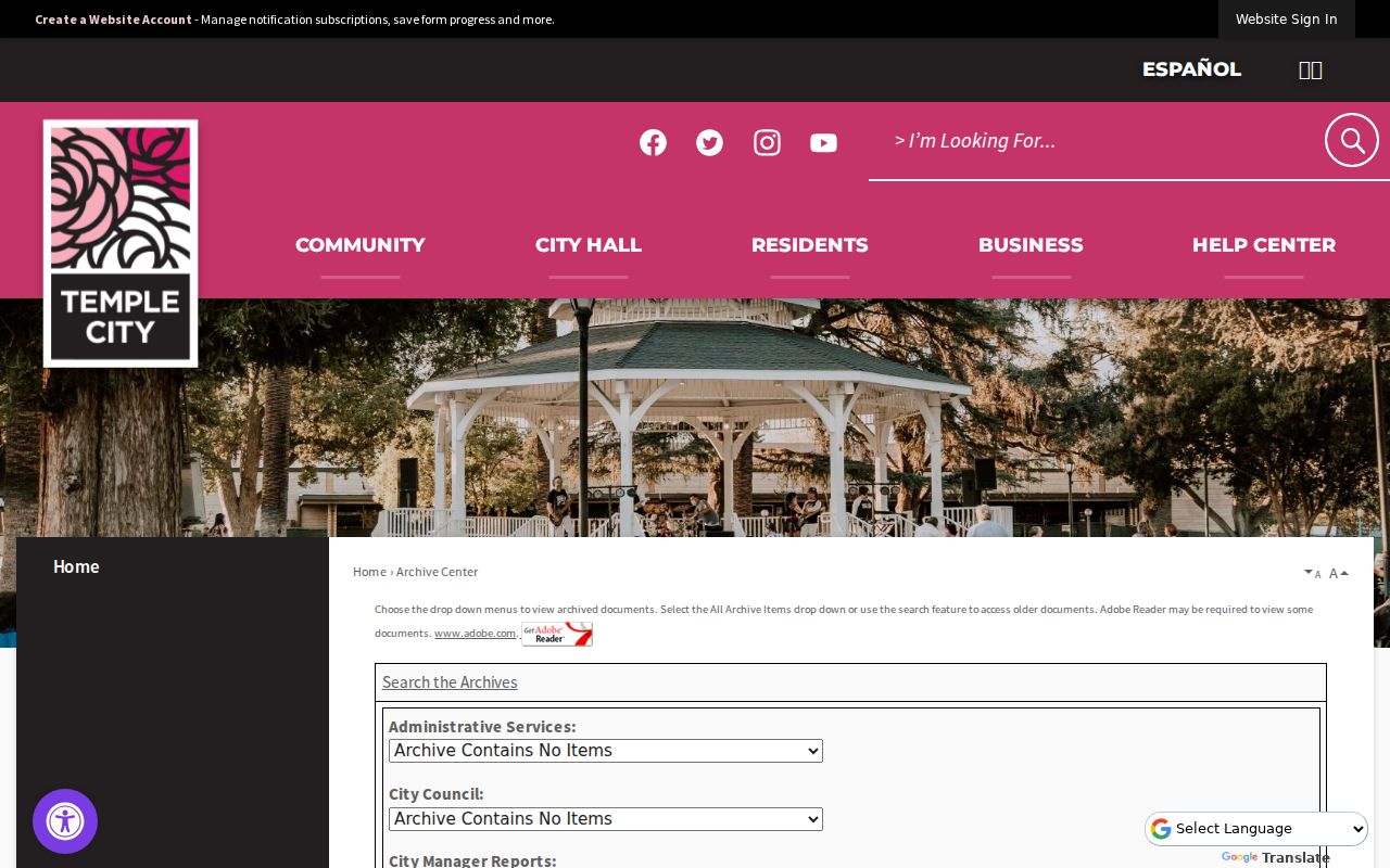
The archive can surface appointments, planning applicants, speakers, awards, and public comments. It adds civic context to a block question, not a list of the people who live on that block.
Map Temple City Neighbors by Parcel
The Assessor Parcel Viewer provides the most direct adjacent-parcel workflow. Begin with a complete address or ten-digit AIN. Once the parcel detail opens, the map lets a searcher move from the subject parcel to the polygons beside it. The result is a parcel table, not a resident roll.
- Enter the exact situs address or AIN in the Assessor search. Save the AIN, situs, parcel status, use type, and map location.
- Open the parcel map and click each adjoining polygon. Record each neighboring AIN and the address or parcel detail returned by the map.
- Compare the parcel facts, building characteristics, and recent-sale flag. The recent-sales layer covers the last 24 months and does not replace a full deed search.
- Use the Assessor counter route only when a lawful records question requires owner or tax-mailing information. Keep that fact labeled as ownership or mailing data.
- Check the city zoning map for incorporated parcels. If a polygon is in an unincorporated county pocket, switch to GIS-NET Public and use its county layers.
For a full named-street record chain, the Temple City street workflow is the better handoff. The block method stays focused on the immediate parcels around one address.
The official Assessor sample parcel detail shows the kind of fields returned by the public card.
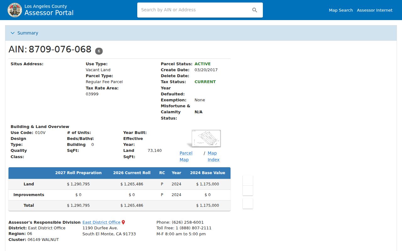
A sample parcel card can display AIN, situs, use, tax area, status, land and building facts, values, map links, and change activity. It does not reveal an owner name or mailing address on the public web page.
Temple City Assessor Parcel Viewer Details
The Assessor portal has Basic Search and Legal Search modes. Its address or AIN autocomplete accepts a physical situs or a ten-digit assessment number. Map Layers include Recent Sales Parcels. The detail view may show building use code, design type, quality class, units, beds, baths, square footage, year built, land size, assessment values, exemption status, and parcel change activity.
The web result is intentionally narrower than a person directory. Online owner-name search is not offered. Owner identity and mailing address are available at the East District Office, 1190 Durfee Avenue, South El Monte, CA 91733, (626) 258-6001, Monday through Friday from 8 a.m. to 5 p.m., or through Property Data Sales. A counter record is still an ownership record. It does not prove who occupies the parcel or who belongs to a household.
Assessment maps are not surveys. The situs is the physical parcel address, the mailing address is a correspondence destination, and the legal description belongs to a recorded instrument. A city label may differ from the physical jurisdiction. Those distinctions matter when a Temple City parcel sits near an unincorporated edge.
Temple City Zoning and County GIS-NET
Temple City Planning links a parcel-specific ArcGIS Online Zoning Map through its zoning and land-use page. The map supplies zoning context for parcels inside the incorporated city. Planning can be reached at planning@templecity.us or (626) 656-7316; the public counter is open Monday through Friday from 8 to 11:30 a.m. and 1:30 to 4:30 p.m.
GIS-NET Public is a Los Angeles County tool intended for unincorporated county territory. Its quick guide describes AIN, address, intersection, property-owner, and coordinate search, plus identify, query, buffer, tract and parcel query, drawing, measurement, export, reports, print and aerial tools. Those functions can help inspect a county pocket or a Sphere of Influence edge, but they should not replace the city zoning map for an incorporated Temple City parcel.
A buffer around an address is a map operation, not a list of nearby residents. It can help define which parcel polygons belong in a block table. The names and household facts that a searcher may want remain subject to the separate limits of the Assessor, voter rules, and privacy programs.
Temple City Neighborhood Watch Areas
Temple City has ten numbered Neighborhood Watch areas. For 2026, the city groups meetings into five pairings: Areas 1 and 2, Areas 4 and 7, Areas 3 and 5, Areas 8 and 9, and Areas 6 and 10. A holiday meeting is also listed. These are geographic civic-safety structures, not public membership records.
| 2026 pairing | What the public route provides |
|---|---|
| Areas 1 and 2 | Joint meeting area and public Watch information. |
| Areas 4 and 7 | Joint meeting area and public Watch information. |
| Areas 3 and 5 | Joint meeting area and public Watch information. |
| Areas 8 and 9 | Joint meeting area and public Watch information. |
| Areas 6 and 10 | Joint meeting area and public Watch information. |
The city publishes a Neighborhood Watch page and a Watch map. The crime-blotter text service uses TCAREAWATCH sent to 888777. Temple Station’s nonemergency number is (626) 285-7171. No public Watch membership or contact roster was located.
Temple City Clerk Archive Search
The City Clerk coordinates public-record requests, records management, minutes, ordinances, resolutions, legislative history, ethics filings, and city elections. Peggy Kuo is listed at cityclerk@templecity.us, (626) 285-2171, City Hall, 9701 Las Tunas Drive, Temple City, CA 91780. A request should reasonably identify records prepared, owned, used, or retained by the city. Staff can help identify a record, while stored files and building plans may require a later inspection appointment.
The city archive search exposes Keywords, Archive, Time Period, Start Date, End Date, and Search. Categories include Administrative Services, Council, Manager Reports, Connect Magazine, Parks and Recreation, Planning, Public Arts, and Public Safety commissions. A surname can surface an appointment, applicant, speaker, award, or comment. It should not be read as a directory of current households.
The Temple City Clerk records contact is shown below as the city-side request route.
The Clerk route is useful when the block question concerns a public meeting, permit record, appointment, or civic action. It does not unlock private household or utility information.
Temple City Chamber Directory Limits
The Temple City Chamber directory is a business and organization search. Its fields include Keyword, Category, City(s), State or Province, County(s), ZIP(s), Country(s), and an any-criteria option. Categories include Church or Religion, Education, Healthcare, Non-Profit, Club or Foundation, professional services, and retail. The Chamber is at 5938 Kauffman Avenue and lists (626) 286-3101, Monday through Friday from 9 a.m. to 5 p.m.
The Temple City Chamber directory search appears below as a visual example.
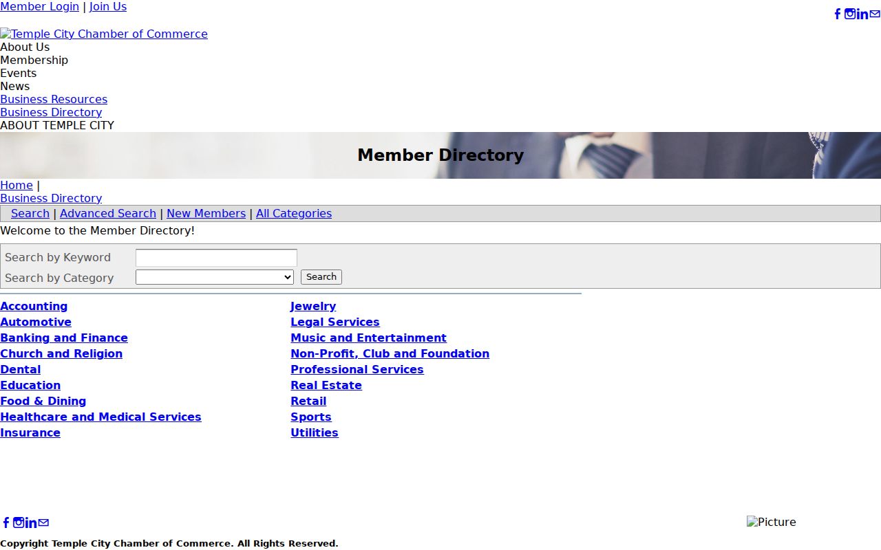
Chamber results identify public business contacts and premises. They do not imply that a business owner, worker, church contact, or club contact lives on the nearby block. No public HOA or civic-association membership directory was located, and the Chamber should not be used as a substitute for one.
Temple City Voter Roll Limits
Los Angeles County’s public voter status form is a self-check. It asks for last name, birthdate, house number, and ZIP code. A supplied match can help a person verify a registration record. It is not a browseable street tool and a nonmatch does not prove that someone is unregistered.
California voter information products are controlled by political-purpose rules. Possible released fields include name, residence or mailing address, phone or email, precinct, party preference, status, and participation history, while SSN, driver or identification number, and signature are not released. Confidential voters are excluded. Ballot participation never reveals ballot choices.
Countywide voter files are listed at $146, precinct, district, or city information at $54, and an additional file at $39. The legacy Street Index is available to candidates and committees at $0.50 per thousand names; the general public route is for political purposes only at $0.10 per page plus $1.60 handling. An applicant signs a contract. Personal or commercial communication, unrelated surveys, solicitation, harassment, and other nonpermitted uses are prohibited.
Temple City Block Records Compared
Official records and generic commercial compilations answer different questions. A parcel map is narrower but auditable. A commercial compilation may combine old deeds, marketing files, and other data, then present a name beside an address without showing the source or the date. Neither category is a substitute for checking the custodian.
| Source type | Useful strength | Block-level limit |
|---|---|---|
| Official parcel and assessment records | AIN, situs, parcel shape, use, values, and a direct map trail | Web owner suppression; ownership does not establish occupancy. |
| Permitted voter products | Regulated registration and participation fields for an approved purpose | No ordinary personal street browse; confidential records are excluded. |
| City and civic directories | Public meetings, businesses, archive entries, and Watch geography | No public household, HOA, or Watch membership roster. |
| Generic commercial compilations | May offer a quick lead drawn from mixed public and commercial sources | Stale or misjoined names, unclear source dates, and no official correction path. |
When a name matters, return to the official parcel, recorder, city, or election custodian. A result that cannot be traced to a source, date, and lawful access route is only a lead.
Private Facts in a Temple City Neighbor Search
Public parcel facts do not expose the full life of a block. Household membership, a person who occupies without owning, utility customers, deliveries, private contact details, and DMV address data are not public directory substitutes. A permit applicant, contractor, business contact, or tax-mailing recipient is not automatically a resident.
California’s Safe at Home program can provide a substitute mailing address and a confidential voter option for qualifying participants and household members. A protected address may therefore disappear from ordinary search routes. Safe at Home does not erase a property’s legal description when someone buys land in their own name, but it does change how a person’s public address is represented.
California’s Delete Act also created DROP for verified requests to active registered data brokers. Requests began in 2026, with brokers retrieving them at least every 45 days from August 1. DROP can remove matched broker data and inferences, but it does not erase the source deed, case, permit, license, or election record held by its custodian.
Lawful use. Temple City neighbor research is appropriate for civic awareness, personal safety planning, reconnecting, and learning the public history of a block. Do not use parcel, voter, archive, or directory information to watch, intimidate, stalk, or harass another person.
A careful neighbor lookup ends with the smallest fact needed for the question: a parcel boundary, a zoning detail, a public meeting, or a source to contact. It does not try to turn public fragments into a private household profile.